~/blog
/
technology
/
gnss-no-internet
Technology
GNSS
// 2026-08-04
~ 15 min read
WHY SATELLITE POSITIONING WORKS WITHOUT INTERNET
Try a strange experiment: put your phone in airplane mode and completely cut off the internet. Now open a map application. Unbelievably, your phone might still be able to find your location.
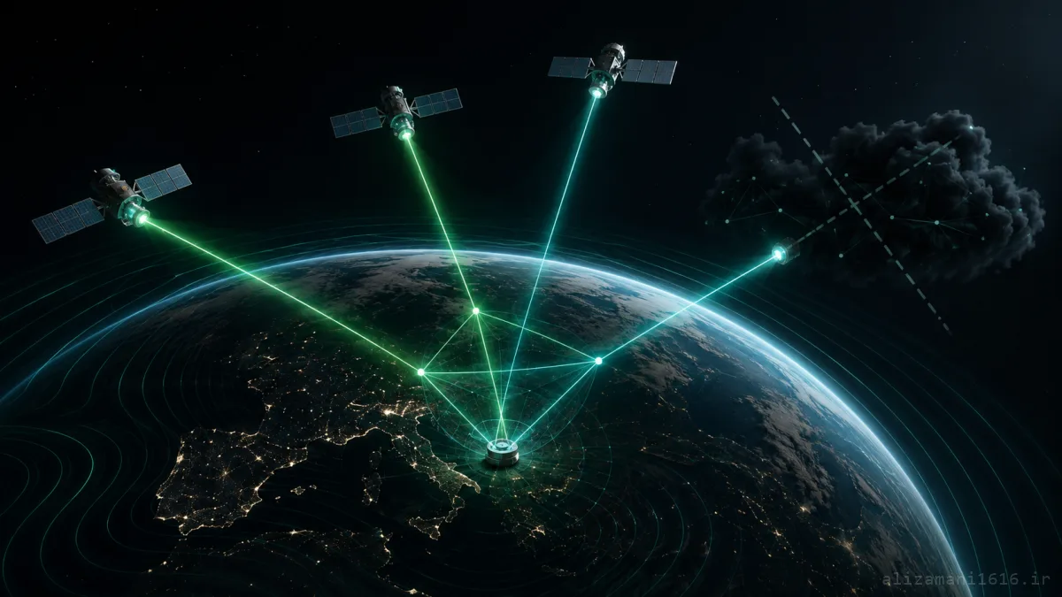
We usually associate location with internet, cell towers, and online maps. But satellite positioning systems have an interesting secret: to know where you are on Earth, they don't need to know who you are. They don't need to send you a message. They don't need to ask a server for your position. They don't even need you to send anything to a satellite. They just need to receive a few signals from the sky... and then, using time, distance, and a few mathematical equations, find your place.
But how is this process possible?
#
A Common Misconception; Positioning Systems and Internet Are Not the Same
First, we need to clear up an important misunderstanding. What we call "GPS" on our phones is actually just one of several satellite positioning systems, collectively known as GNSS (Global Navigation Satellite System).
GPS is the American system, but there are others:
🇺🇸 GPS
American system — oldest and most well-known
🇨🇳 BeiDou
Chinese system — with global coverage
🇷🇺 GLONASS
Russian system
🇪🇺 Galileo
European system
Modern phones typically use a combination of several of these systems simultaneously. But they all share a common principle. GNSS is a satellite-based positioning system and Google Maps or any map application is software that displays your location on a map. These are not the same thing. The positioning system can only tell your phone:
Latitude: 35.6892 Longitude: 51.3890
But where these coordinates are placed on the map, what the street name is, which route comes next, and whether there's traffic on the street ahead — that's the job of the map software and auxiliary data.
ⓘ
Therefore, it's possible to have:
GNSS Internet
And your phone can still calculate your geographic location. Of course, for displaying online maps, receiving traffic information, searching for places, and many other features, you still need internet — unless you've saved the maps offline in advance.
#
Satellites Never Ask Where You Are
One of the most interesting parts of GPS is right here. You might imagine that your phone sends a request to a satellite: "I am here, please calculate my location."
But this doesn't happen. GPS satellites primarily act as transmitters. They constantly send radio signals toward Earth, and the GPS receiver inside your phone, car, or navigation device receives these signals.
✓ Reality
Satellite
Radio Signal
GNSS Receiver
✗ Wrong
Receiver
Request
Satellite
That's why satellite positioning can work without internet. Your phone just needs to be able to receive and process satellite signals.
ⓘ
In reality: The GNSS receiver calculates its approximate distance from several satellites by processing signals sent from them, measuring signal transmission time, and using information about satellite positions.
#
So How Does Your Phone Know Where the Satellite Is?
This is where satellite positioning gets a bit more complex. Each satellite isn't just a "bright dot" in the sky. The receiver needs to know where the satellite is positioned and exactly when the signal was sent.
For this reason, satellite signals include navigation data that includes time data and information about the satellite's orbit and position. Two important concepts exist here:
Ephemeris
More precise information for calculating the position of that specific satellite at a given time
Almanac
Coarser, less accurate information about the status of the satellite constellation
Using this data, the receiver can figure out: "Where is this satellite approximately right now?" Now only one question remains: "How far am I from this satellite?" And the answer to this question is the heart of satellite positioning.
#
Satellite Positioning Actually Finds Your Location Using "Time"
Suppose a satellite sends a signal at exactly a specific time. The signal travels at the speed of light and your phone receives it a few moments later:
Satellite Time = 12:00:00.000000
↓ (speed of light)
Receive Time = 12:00:00.070000
If we know how long the signal has been in transit, we can calculate the approximate distance from your phone to the satellite:
d = c × Δt
Distance = Speed of Light × Signal Travel Time
In GNSS, this distance is more precisely called a Pseudorange or "pseudo-distance," because it also contains errors related to the receiver clock, satellite clock, and signal path:
ρᵢ = ||r - sᵢ|| + cΔt + εᵢ
Where ρᵢ is the measured distance from satellite i, r is the actual receiver position, sᵢ is the position of satellite i, c is the speed of light, Δt is the receiver clock error, and εᵢ represents other errors.
The receiver ultimately needs to solve for its own position and clock error from several measurements.
#
The Main Trick; One Satellite Isn't Enough
Suppose we only have one satellite. If we know your distance to that satellite is 20,000 kilometers, you could be anywhere on the surface of a sphere with a radius of 20,000 kilometers.
Satellite Progression
1 Satellite
A large sphere of possible positions
2 Satellites
Much smaller range
3 Satellites
Position in 3D space
4 Satellites
+ Clock bias correction
But there's a big problem: your phone's clock isn't as accurate as the atomic clocks on satellites. And that's where the fourth satellite comes into the story. The receiver needs to find four unknowns:
X
Position on X axis
Y
Position on Y axis
Z
Altitude
Δt
Receiver clock error
Therefore, in normal conditions, the receiver needs at least four satellites to solve for a three-dimensional position. Here satellite positioning moves away from a "magic map" and becomes a real problem of geometry, time measurement, and solving nonlinear equations.
#
What's This Technique Called?
You may have heard the term Triangulation. But satellite positioning systems don't classically use angles to find position. Satellites mostly tell you: "How long has my signal been in transit?" And from that, the approximate distance is calculated. So the main concept is Trilateration.
Trilateration
Each satellite creates a specific distance range. Where these constraints are compatible with each other, that's your position.
Of course, real satellite positioning isn't this simple. We deal with clock errors, satellite orbit errors, ionospheric and tropospheric delays, signal reflections from buildings, and other errors. But the main idea remains the same:
Multiple satellites + signal time measurement = your position
#
If We Want to Simulate the Positioning Idea with Python
Suppose we have the positions of four satellites and each has given us a measured pseudorange. We need to find four unknowns: x, y, z, clock_bias. For a simple educational model, we can solve the problem with a numerical solver:
import numpy as np
from scipy.optimize import least_squares
# Satellite positions (km)
satellites = np.array([
[15600, 7540, 20140],
[18760, 2750, 18610],
[17610, 14630, 13480],
[19170, 610, 18390]
], dtype=float)
# Measured pseudoranges (km)
pseudoranges = np.array([
23286.8756,
23756.9694,
23450.3619,
23952.3185
])
def equations(x):
"""x[0:3] -> position, x[3] -> clock bias"""
receiver_position = x[:3]
clock_bias = x[3]
distances = np.linalg.norm(satellites - receiver_position, axis=1)
return distances + clock_bias - pseudoranges
solution = least_squares(equations, np.zeros(4))
x, y, z, clock_bias = solution.x
print("X:", x, "Y:", y, "Z:", z)
print("Clock bias:", clock_bias)
▶ X: 1000.0 Y: 2000.0 Z: 3000.0
▶ Clock bias: 100.0
Of course, this code isn't a real receiver. In a real receiver, before such equations can be solved, the RF signal must be received and processed, satellite codes must be identified, signal time must be extracted, and orbital information and various errors must also be included in calculations. But this code demonstrates that satellite positioning is ultimately a computational problem that estimates your position from several distance and time measurements.
Important note: Your phone's GNSS receiver is doing something much more complex than this example, but the fundamental idea is still based on these measurements.
#
So Why Does Internet Sometimes Make Positioning Faster?
If satellite positioning works without internet, then why does our position usually get found faster when internet is on? Here we need to distinguish between GNSS and Assisted GNSS or A-GNSS.
To find position from satellite signals, your phone must first find visible satellites and receive and process the required data. This process can sometimes be time-consuming. But when your phone has access to internet or mobile network, Assisted GNSS systems can provide the required auxiliary information to the receiver more quickly and reduce the time to first fix or Time to First Fix.
Therefore, internet doesn't necessarily make positioning "possible." It can only help your phone find its position faster and sometimes better by combining different resources:
GNSS Modes
GNSS without internet
I can find my position
GNSS + Assistance Data
I can find my position faster
GNSS + Wi-Fi + Cellular
Best estimate in all conditions
#
So Why Does Satellite Signal Get Weak Indoors?
Now you probably understand why satellite positioning performs poorly inside buildings, parking lots, and between tall buildings. The satellite signal must travel a very long distance to reach your phone. GNSS satellites are in medium Earth orbit at an altitude of about 20,200 kilometers, and the signal that reaches Earth is very weak.
If a building, concrete wall, or enclosed environment blocks the signal path, the receiver has a much harder time extracting accurate information. Signal reflections from buildings can also create errors — a phenomenon in GNSS called Multipath.
ⓘ
So when satellite positioning doesn't give you an accurate position inside a shopping mall or parking lot: The problem isn't that satellites "don't know this place"; the issue is that the incoming signal isn't reliable enough for accurate measurement.
#
And Now the Unbelievable Part; Satellite Positioning Depends on Einstein's Theory of Relativity
You might think satellite positioning is just a combination of satellites, radio, and a few geometric equations. But the story is even stranger than that. GNSS couldn't work with today's accuracy without considering Einstein's theory of relativity.
GNSS satellites have very precise clocks, and positioning is heavily dependent on time. But a satellite clock that moves rapidly in Earth's orbit and is in a different gravitational field than Earth's surface doesn't work at exactly the same rate as a clock on Earth:
Special Relativity
Rapid motion makes the satellite clock run slower
General Relativity
Weaker gravity at altitude makes the clock run faster
The combination of these two effects means satellite clocks run about 38 microseconds per day faster than clocks on Earth. 38 microseconds might seem like a completely insignificant number. But satellite positioning finds your position using time.
Why 38 microseconds matter
38 μs/day
Signal travels 38 μs extra
38 μs × speed of light
300,000 km/s × 0.000038 s
≈ 11 km distance error
Meaning if this 38 microseconds weren't corrected, every day your position would drift about 11 kilometers from your actual location. Within a few days, the blue dot on the map wouldn't be on your street anymore — it would be several neighborhoods away!
ⓘ
That's why relativistic corrections are essential to GNSS: Not a side feature or luxury. Meaning every time you see a blue dot on the map, behind the scenes you're seeing a system that requires Einstein's relativity effects to be considered for accurate operation.
#
Why Does the Blue Dot on the Map Appear So Quickly?
Now we can put the whole story together. When you activate positioning on your phone, something like this happens:
GNSS Pipeline
1
Receive satellite signals
2
Measure signal arrival time
3
Calculate satellite positions
5
Solve Trilateration equations
6
Correct receiver clock error
Latitude + Longitude + Altitude
Display point on map
And all of this can happen without your phone receiving even a single byte of data from the internet. Internet can only enter the story in other parts:
Internet Role
Download maps
Receive traffic info
Search places
Assisted GNSS
Improve first fix time
But satellite positioning itself doesn't depend on a constant internet connection.
#
One Satellite, One Clock, and a Few Equations
Every time you drive on a road without internet and the blue dot on the map moves exactly with you, a very complex event is actually happening.
Satellites about 20,000 kilometers above Earth are broadcasting signals into space. Your phone receives them. It measures the signal arrival time. It calculates satellite positions. It compares several distances. It finds its own clock error. It solves the equations. And finally tells you:
"You are here."
Without asking you. Without needing to communicate with you. And without you even knowing that several dozen satellites are currently sending signals above your head.
GNSS is actually a massive system for measuring time that we use the result of to find location. And perhaps the most fascinating part of the story is this:
Sometimes to figure out exactly where you are, you don't need to connect to the internet; you just need to listen to the signals coming from the sky.
The blue dot on the map looks simple;
but behind it, time, distance, geometry, and relativity
have joined hands to say:
You are exactly here.